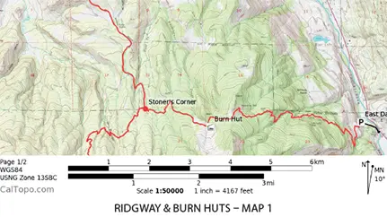
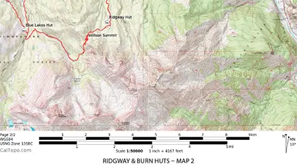
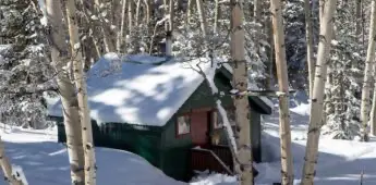
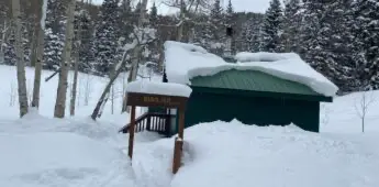
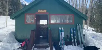
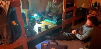
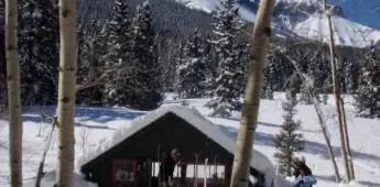
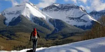
Situated in a lovely aspen grove, the Burn Hut is perfect for beginner to advanced Backcountry Travelers. Burn hut is accessible on cross-country skis, AT setups, and snowshoes. There is great beginner to intermediate terrain accessible from Burn Hut. This hut sits at 9,940′ on a slope with views of the Sneffels Range. The Burn Hut is the farthest east of all our Ski Huts and closest to the town of Ouray. It is frequently used in conjunction with the Ridgway Hut for multi-day adventures. A short 5-mile drive on CR5 out of Ridgway takes you to the trailhead for both the Ridgway and Burn huts. A 5.7-mile ski along a summer trail/dirt 4×4 road, with awesome views of the entire Sneffels Range, leads you to the Burn Hut. The Burn Hut accommodates eight people via padded bunk-style beds. The hut includes a propane stove, propane lamp, solar-powered lights, a wood stove, firewood, cookware, utensils, and a composting toilet. Water is obtained by melting snow. Hut users are responsible for treating water with iodine, pump & filter, or UV scanner. During the winter months, the Blue Lakes Hut costs $30/per person/night.
December through April
Our mountain huts hold eight people per night. The wooden huts are equipped with padded bunks, a propane cook stove, lights, a wood stove, necessary utensils, cookware, and firewood. Each hut is equipped with a composting toilet facility.
Rent the entire hut or just a few spots!
-8 booking minimum on weekends and holidays $30 per person/night
AT skis/splitboard, skis, poles, boots, clothes, first aid kits, food, and a sleeping bag. Our huts have everything else. See the Skier’s Bible for a more detailed list.
Call us at (970) 626-3033 or send us an email.

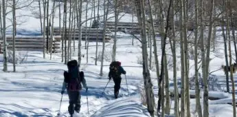
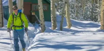
“The past 4 days was our second trip into the North Pole Hut on the winter route. You just can’t beat the fact that you’ve usually got the hut to yourself, there’s so few people that make the trek in. All the bare basics are already in the hut – you bring whatever else makes you comfy – but you’d better make it a light backpack AND be ready for anything. If you can do that, you will be rewarded. We’ve already booked the 7 day Durango/Moab bike trip on the other set of huts! I can’t thank SJHS enough for having these gems socked away deep in the mountains, ready for us when we need them!”
~ Eric K, Cortez, Colorado
What's Included
Our staff is available for in-depth trip planning and can offer individualized insight after getting to know you and your group.
Located on private property and within National Forests and BLM administered lands, our ski huts are used exclusively for our clients and are stocked with everything you’ll need for rest, hydration and cooking. Equipped with 8 padded bunks, sleeping bags, propane cook stove & lighting, wood stove, cookware and composting toilet.
Our detailed maps, turn-by-turn directions, and GPS tracks help you stay on route. Winter huts can be linked together for multi-day trips or used individually as basecamps for your skiing adventures.
Each ski hut has a woodstove and is supplied with ample firewood for the winter.
Ski Hut FAQ
San Juan Huts offers custom winter shuttles, and they must be booked at least 30 days in advance. TelluRides is another option: www.TelluRides.com [email protected] or 970.626.5121
- Ridgway Adventure Sports: www.ridgwayadventuresports.com (970) 626-8500 (Skis, boots, poles, climbing skins, shovel, beacons)
- Boot Doctors: www.bootdoctors.com (970) 728-4581 (Skis, boots, poles, climbing skins, shovel, beacons)
- Peak Mountain Guides: www.peakguides.com (970) 325-7342 (Skis, boots)
Light to medium weight gear works getting to and between the huts. Except for Spring Creek and Blue Lakes, skis with climbing skins are recommended. Above the huts, full “backcountry” gear is recommended. Get out in the snow before you leave on your trip and learn your capabilities and the capabilities of your equipment.
Be prepared for varying terrain and conditions for hut to hut travel. Route-finding skills are important and the tracks may be obscured by fresh snow. It takes approximately three to eight hours between huts.
Between most huts avalanche danger is very minimal with one exception: between Last Dollar and North Pole Huts there are eight points of potential avalanche danger, and two of the eight points require real avy-savvy to negotiate. Above most huts a variety of non-avalanche as well as potential avalanche terrain exists. Skiers should have at a minimum some working knowledge of avalanche ‘mechanics’ while venturing above the huts. Proper avalanche equipment (shovel, beacon, probe, and a brain) is also recommended.
More Hut Adventures


